The GPX Track is for guidance only and may contain errors. Use at your own risk.
– always check maps, weather and conditions before your trip.
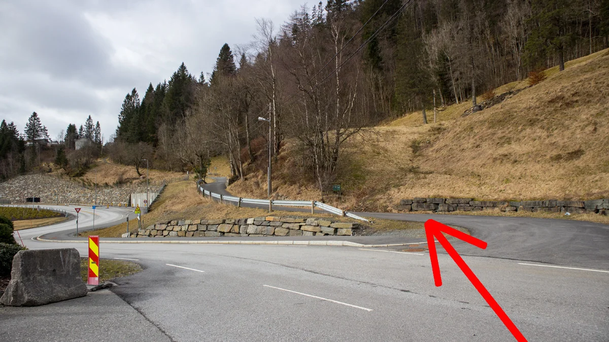
From Nesttun, drive towards Os. At the roundabout with UNO X/Menu, take the first right sign 'E39/Stavanger' towards Halhjem. Drive right at the Next roundabout and then take the first right on the side road. Drive right at Ulvenparken and park here.
The walk starts at the parking lot. Walk in the direction you came from and cross the road.
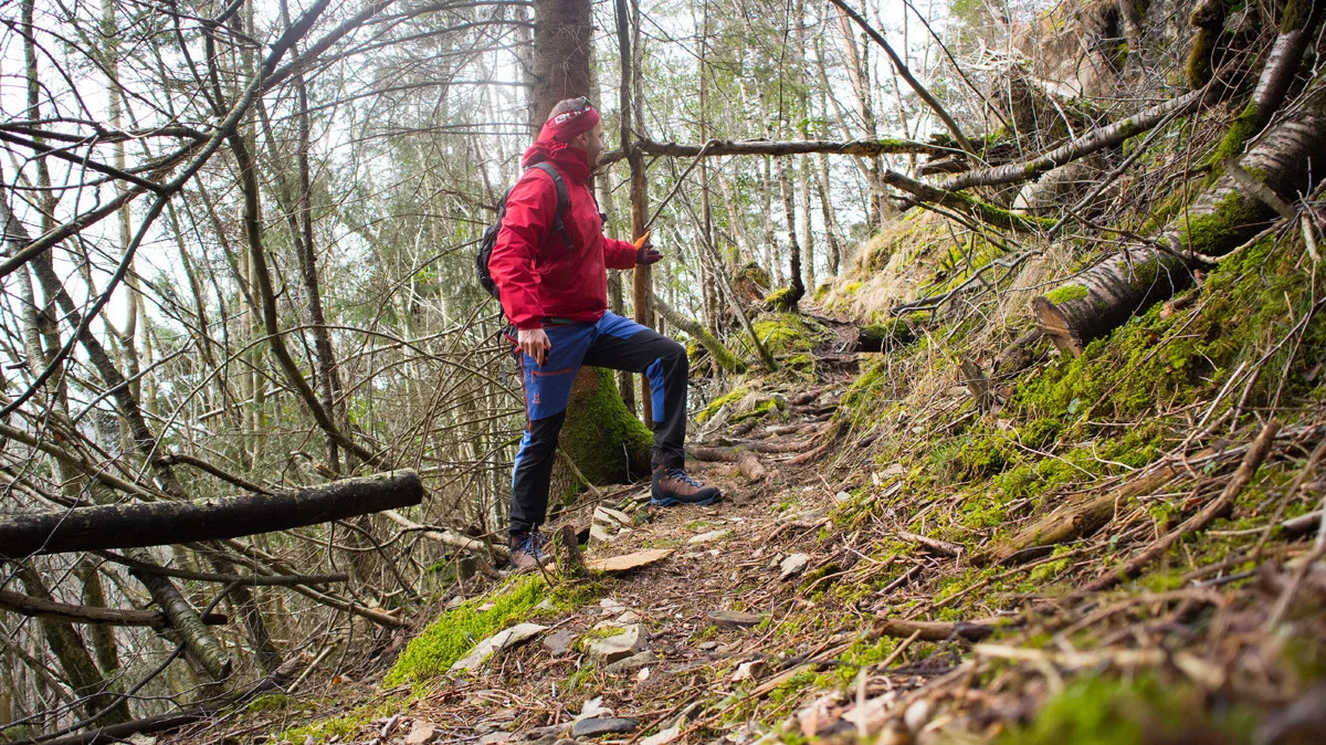
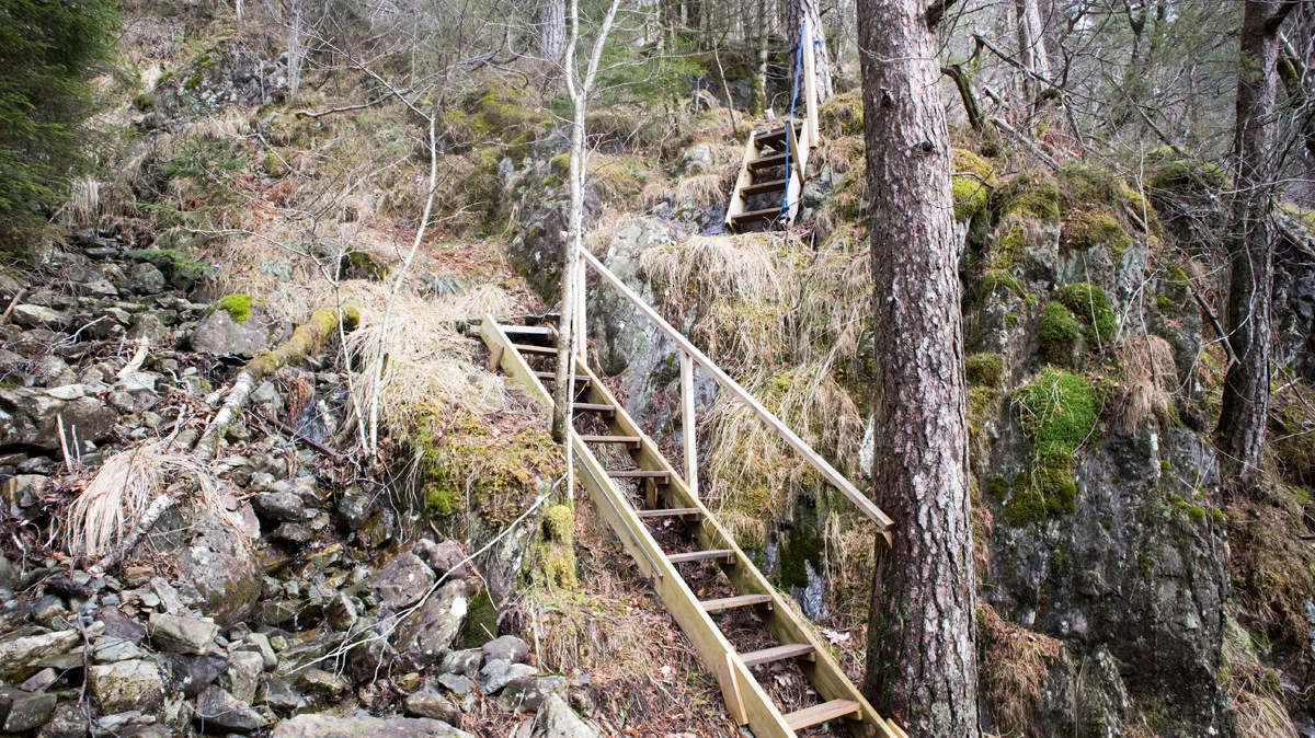
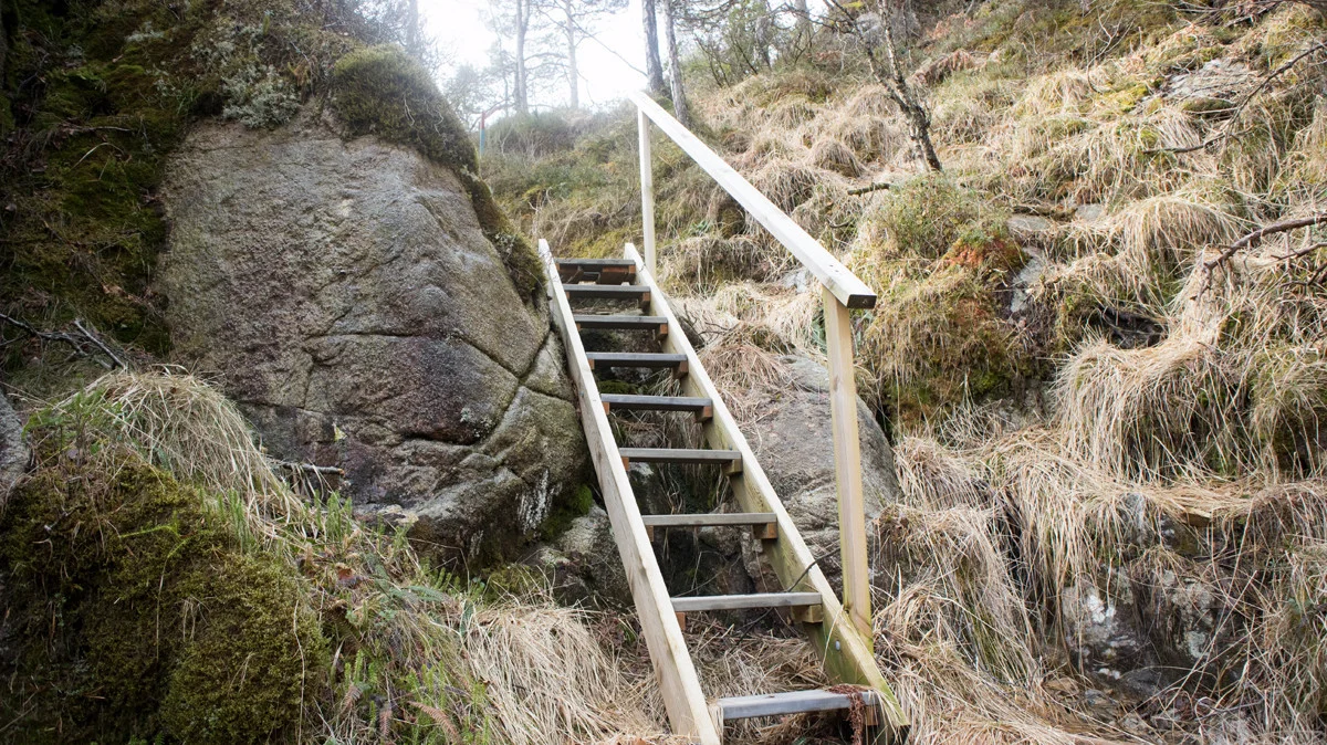
Follow the paved road 'Svegane' along the slope above the tunnel. Go up the hill until you have a house and parking lot on the left. Here a path goes to the right into the spruce forest. It is good so just follow it zigzag through the forest. After a while you will come to a stream bed/stone wall. The path follows this stone wall and it gets steeper. Here Os Turlag (I think) has made beautiful stairs. After the stairs there are red and blue marks in the trees.
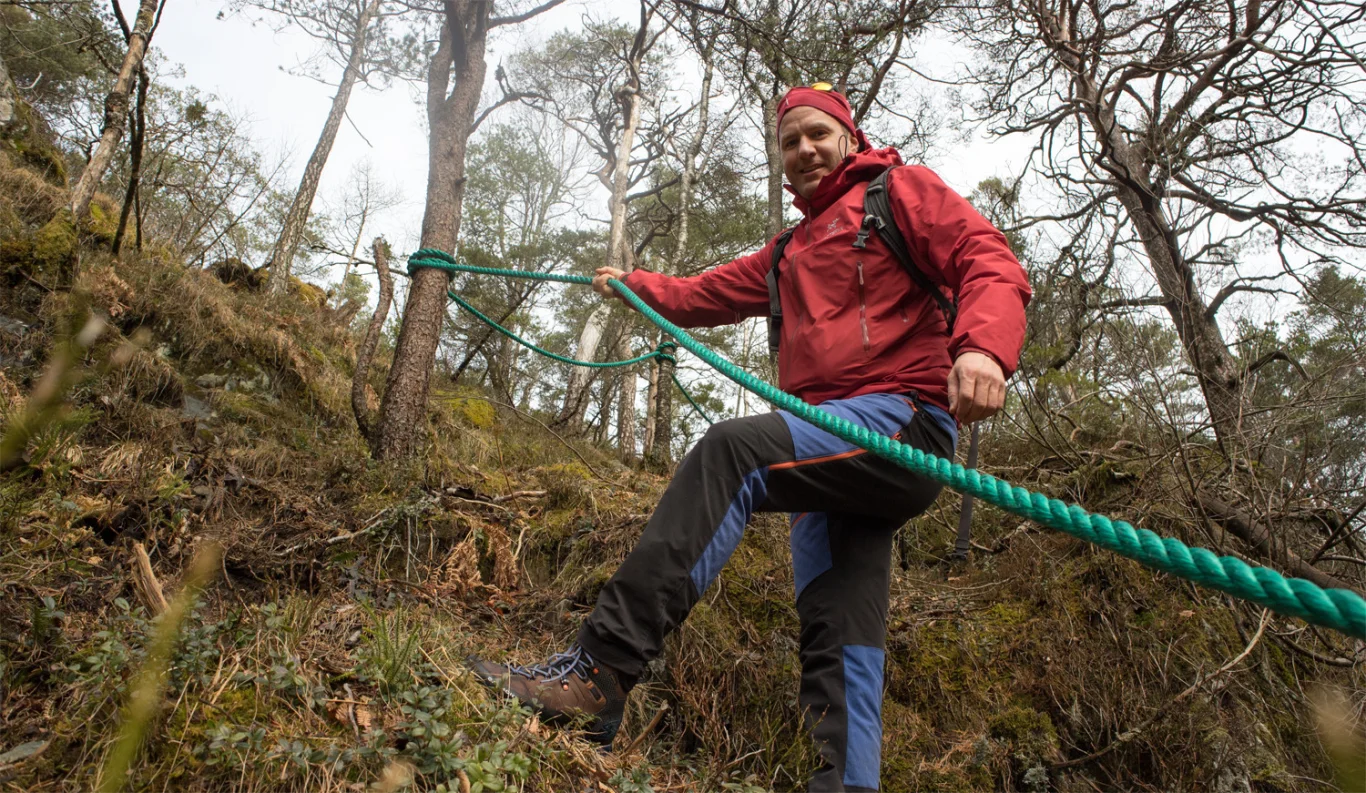
The path is still good and leads straight ahead. Just after the bog flattens out you come to a crossroads. Go left up new stairs. (NB: The path marked straight ahead also leads to the top, but the path to the left is the best choice). Follow the path in a curve around the ridge. Now it is marked with wooden pegs in the ground. There are also ropes laid out on the last climb. Shortly after it flattens out and you arrive at the viewpoint.
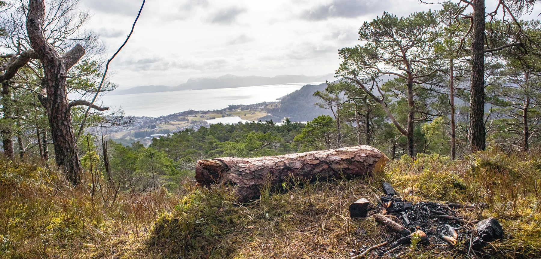
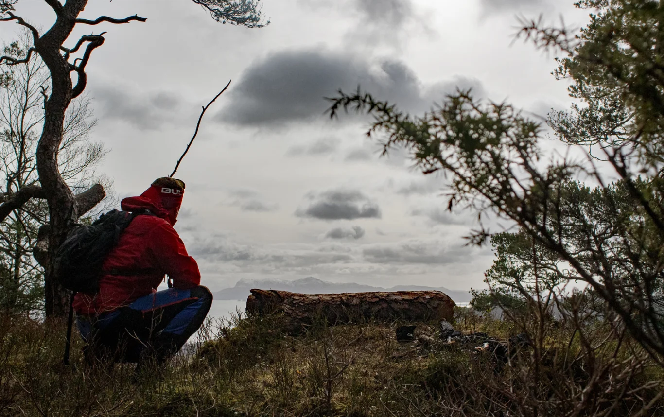
Here, the forest has been removed and a tree trunk has been laid down where you can sit and enjoy the view of Ulven and Bjørnafjorden.
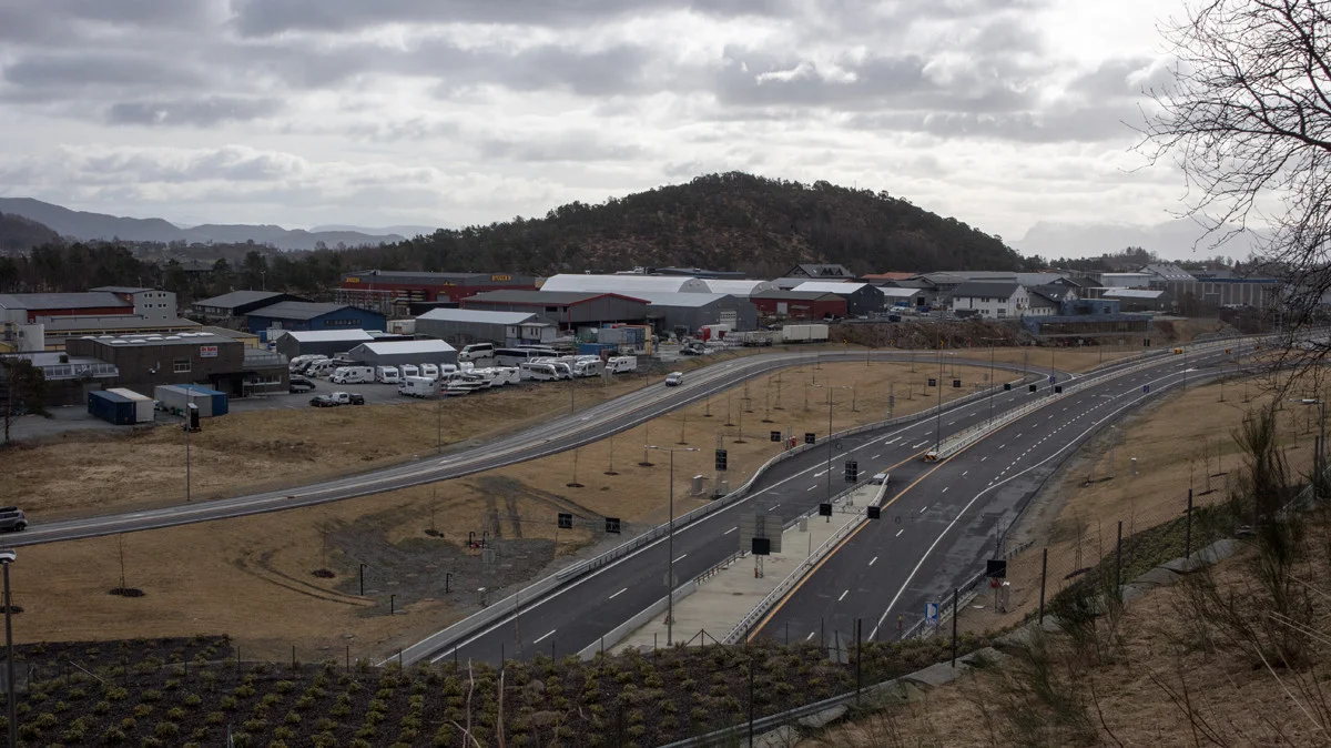
The actual summit is located approx. 75 m. to the north. Follow the wooden pegs further to get here. Here the view is more mixed, but you can see the new tunnel exit from a tough angle.
As the name suggests, there is a lot of forest on Skogafjellet. There is no mailbox at the top. Return the same way.
Good luck!