The GPX Track is for guidance only and may contain errors. Use at your own risk.
– always check maps, weather and conditions before your trip.
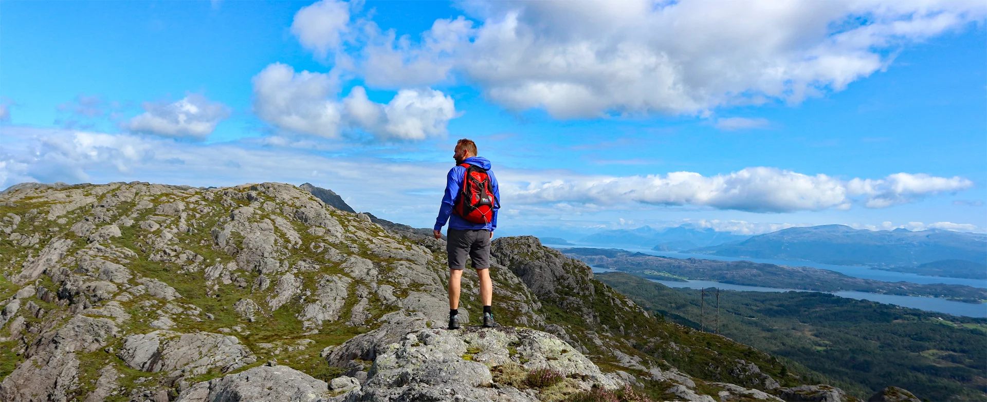
Great panoramic hike to Stovegolvet over Stordfjellet.
Part 1. Trip description to Mennene (505 m).
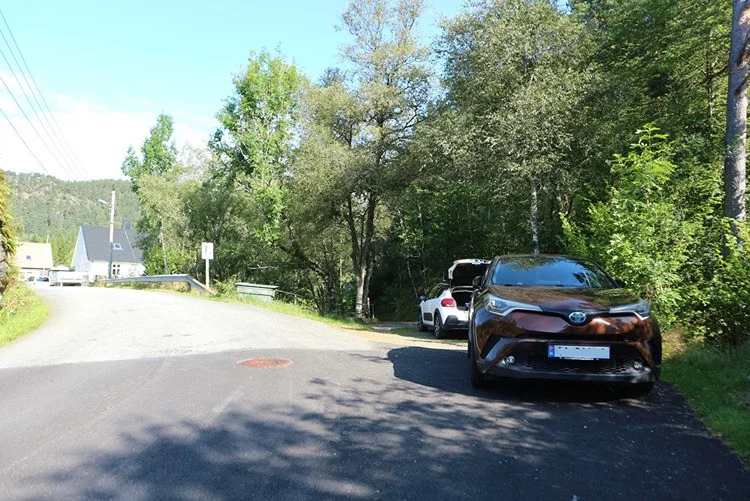
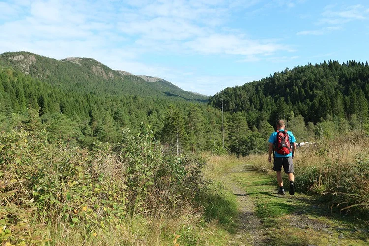
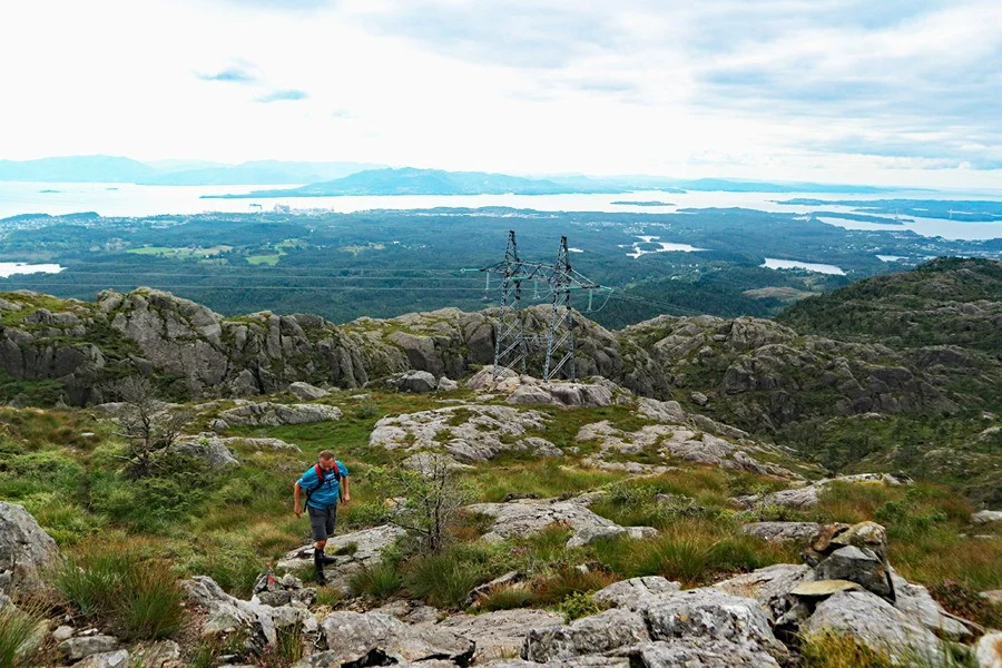
Follow the forest road into the forest and past the open space. From there, the forest road continues a few hundred meters northeast before turning onto a path. Follow the path and cross the bridge over the river. The terrain is flat and the path is good. The path now leads into the forest under the high-voltage line and then on the left side under it.
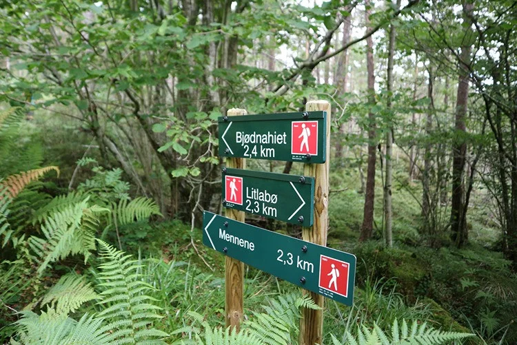
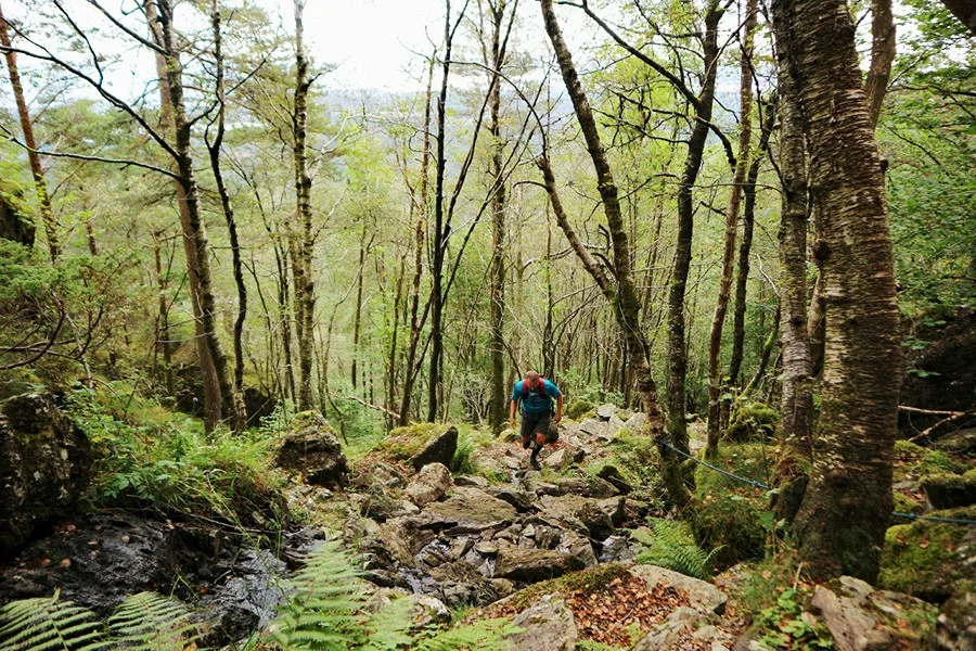
You will now come to a new crossroads where you should go straight ahead, following the sign 'Mennene 2.3 km'. The path now leads you up Bjørnastegen. This is a steep pile of rocks where you have to climb in some places. Ropes have been laid out in the worst places.
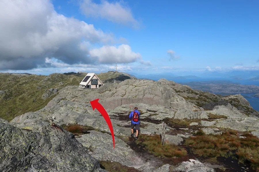
When you finish Bjørnastegen the terrain flattens out, and you enter a terrain that can be called Stord's answer to the Grand Canyon. Go to the cabin and then continue on the path to the right. Follow the path up into the large bog that is surrounded by gigantic cliffs. It can be reminiscent of a large outdoor stage.
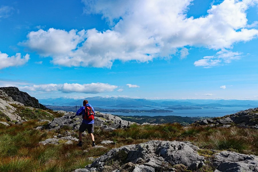
The path continues on the left side upwards, and you will now pass the tree line. You will now have a nice view of the fjord. Follow the path marked with small stone cairns until you see the summit cairn on the left side.
Part 2. Tour description panoramic tour to Stovegolvet.
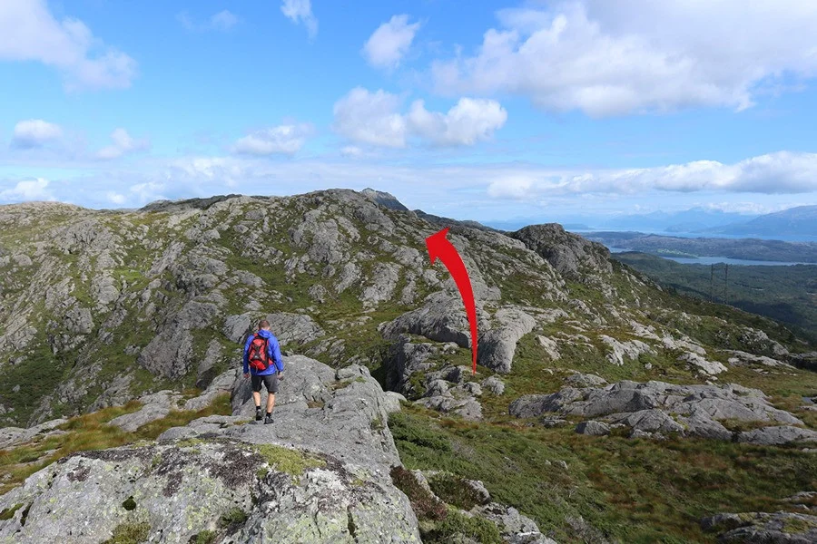
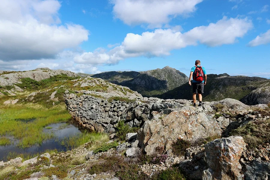
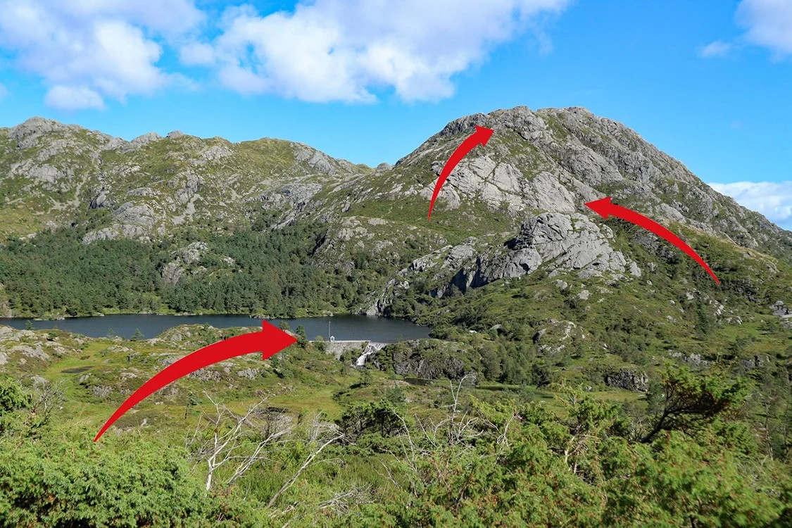
From Mennene, follow the mountain ridge north towards Stovegolvet / Kattnakken. First, the ridge leads about 100 meters down where you will see small cairns. Follow the cairns that lead further along the ridge. It is easy mountain terrain and the view is great. New ascent and the cairns lead back up 500 meters. Follow the ridge further north to the right of Klovfjellet. You will cross the path that leads to Klovfjellet. Walk on the right side of the small, unnamed lake with a stone dam in front.
Continue on the ridge towards the left side of Ravatnet. The descent to Kløv is somewhat steep. You must be careful here, especially on the slippery rocks. Alternatively, you can follow the Klovfjellet trail to go around on the left side.
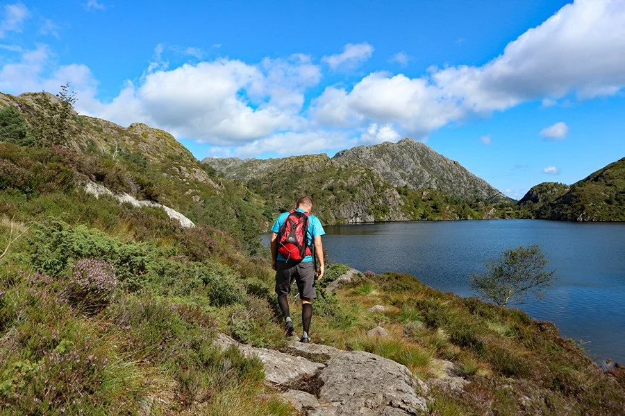
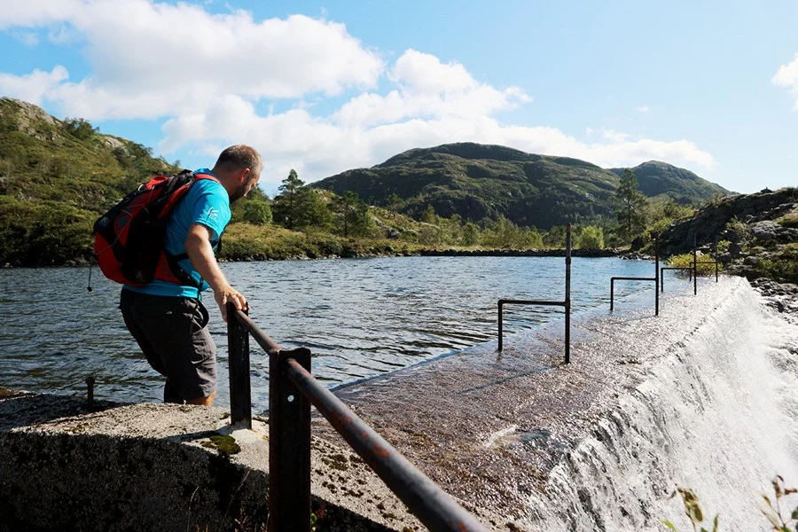
When you have come down the slope, you go past the cabin and to the crossroads at Ravatnet. Here you should go left, signposted 'Lundsseter'. Follow the path on the left side of the water up via the cabins. Here comes another crossroads and you should again go left, signposted 'Lundsseter'. Follow the path down to Tysevatnet and to the dam. Hold on to the posts when you cross the dam. Be careful if there is a lot of water.
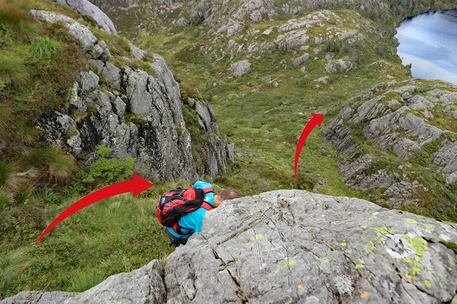
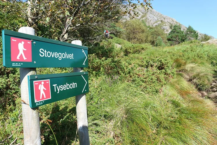
Now the steep climb to Stovegolvet begins. Follow the path to the left (this is a bit unclear, but there is a red marker). It leads you onto the main path to Stovegolvet. Follow the path to the top of the mountain. It is steep and you have to climb in some places. But there are no exposed sections.
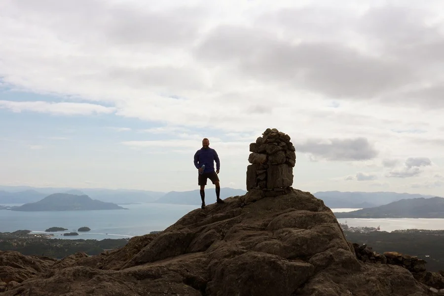
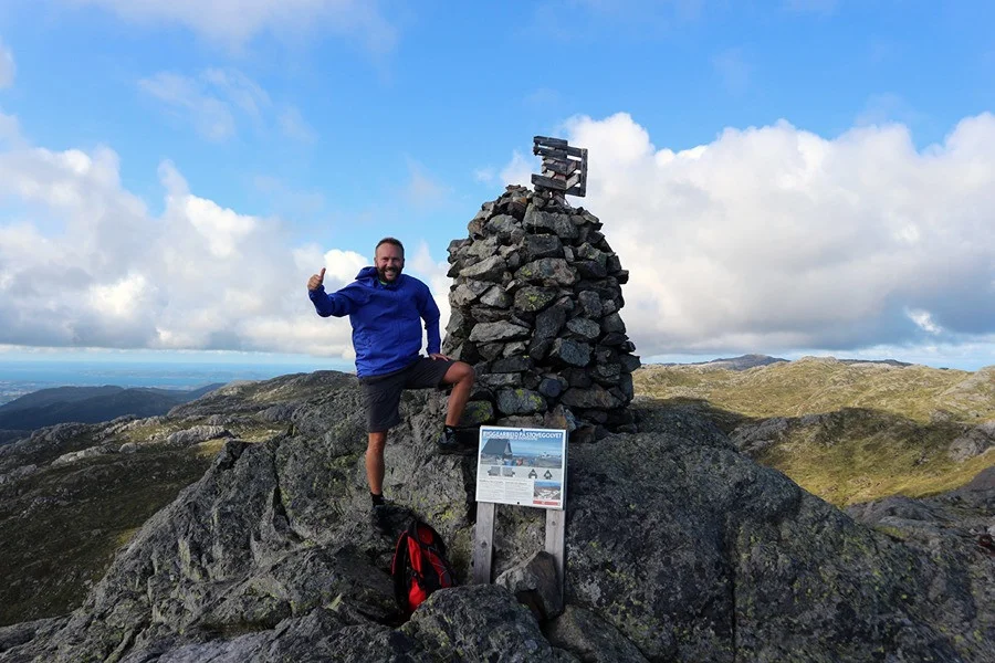
At the top you can enjoy Stord's most beautiful view. Write your name in the book to go and see the beautiful DNT cabin that was completed in 2022.
We recommend continuing towards Kattnakken (the mast) and down to the parking lot at Heia via the Sherpa stairs.
The trip will then be a total of approximately 13 km.
Have a good trip!