On a trip Norway - Top 5 mountain hikes on Osterøy

Osterøy is a popular place for mountain hikes. This is likely due to the many mountain peaks that offer fjord views.
Annonse


The most famous of them with a fjord view is Bruviknipa. The highest mountain on the island is Høgafjellet. Here you don't get as close to the fjord, but there is a nice 360-degree view in all directions. Here we have made a list of our top 5 favorites.

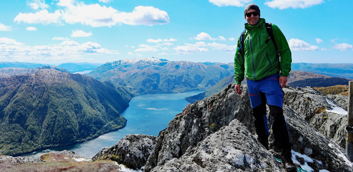
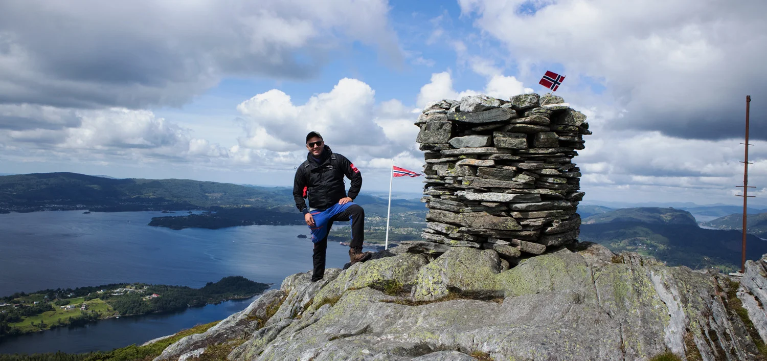
Bruviknipa, locally known as Brøknipa, clearly protrudes from Sørfjorden with its height of 822 meters. From the parking lot at Båtaleitet, there is a clear path marked with yellow stakes. Just before Botnavatnet, there is a fork. Here you go left up the summer path.
The shortest way to the top is through the summer path. Although it is steep, it has no exposed sections. However, it is not recommended to take this path in winter. At this time, it is better to choose the route via Borgasetra, even though it is longer. From the top of Bruviknipa, you get an impressive view of Sørfjorden. From here you can see nearby peaks like Hananipa and Gullfjellet. For a great round trip, it is suggested to go down via Borgasetra.
")
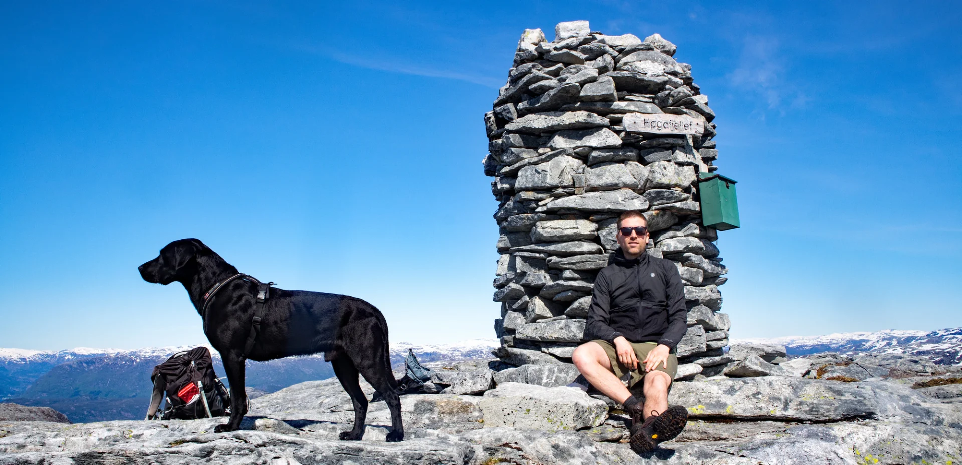
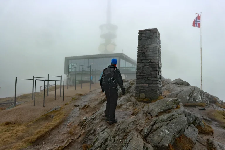
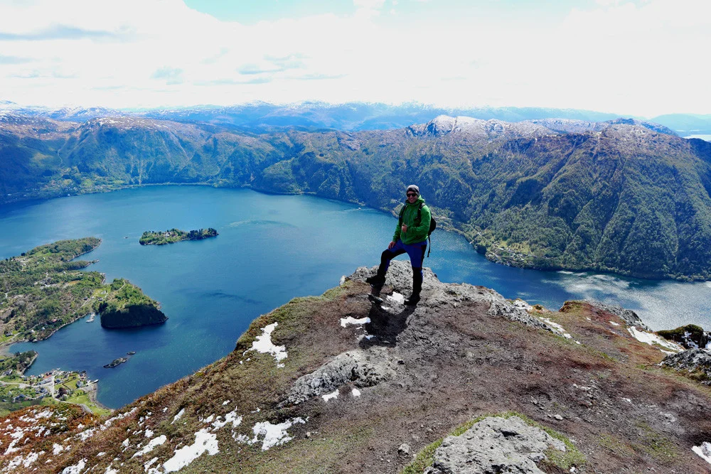
Høgafjellet on Osterøy is the highest point on Norway's largest inland island. Start the hike at Osvatnet parking, follow stairs and path marked with yellow signs to Nedra Botnavatnet. Walk along the north side of the water past a small farmstead and continue through a gate.
Follow the path to Øvrebotnen waterfall, cross the bridge, and go up the stairs to the dam. Walk along the north side of Øvrebotnen with a rope for support in exposed areas. Pass the cabin and continue up the ridge. Follow the path south past Høgaheim cabin, towards the top. When you pass a large stone, you finally see Høgafjellsvarden. At the top, there is a 360-degree view: Rispingen and Brøknipa to the south, Bergsdalen to the east, Sørfjorden and Arna to the southwest. It is recommended to return along the same route.
-
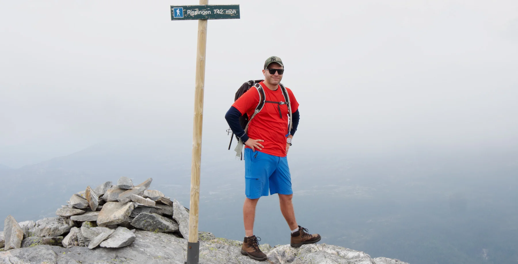
Hike to Rispingen (742 m) from Båtaleitet - Moderate

Turen starter ved Båtaleitet. Følg hovedveien nordover like rundt svingen. Her starter stien til Rispingen på høyre av veien. Stien går i jevn stigning til toppen av Olsensnipa hvor terrenget flater ut. Nå kommer du til et stikryss. Her fortsetter du videre på stien nordover til varden på Raudskredbruna. Her er det fin utsikt mot Stanghelle. Etter dette går stien først nordiver og deretter i nordvestlig retning. Toppen av Rispingen ligger et stykke innpå fjellplatået. Det er ingen varde, men et skilt markerer toppen.
-
Hike to Stemmesegga (573 m) from Haus - Moderate

From the youth house, go out onto the main road and turn right. Continue along the road for about 300 meters until you see the sign marking 'Stemmesegga' on the left side. Walk through the farmyard and follow the forest road along the stone fence. Cross the gate (remember to close it) and pass an old shed. From here, the terrain gradually rises as you follow the forest road through the spruce forest. When the forest road ends and flattens out, you will reach a large bog. Cross the bog straight ahead, following the marked wooden sticks. Just beyond the bogs, the trail improves significantly. Follow the trail that winds up the mountainside until you reach the top. The trail is clearly marked with wooden sticks all the way.
At the top, there is a large cairn. Enjoy the beautiful view over Sørfjorden while looking directly across to Garnes and Ytre Arna.

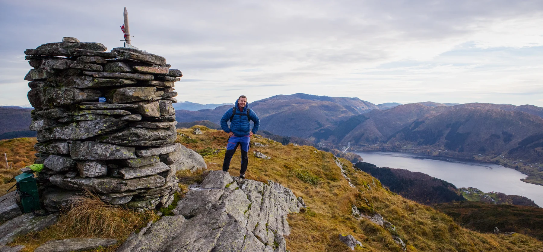
From the parking area for Åsheimveten, there are two options: 'Easy' route and 'Steep' route. We chose the latter. The trail leads up the mountainside. There are some steep sections where ropes have been placed. At the top, there awaits a cairn, a flagpole, and panoramic views over Osterfjorden and Nordhordland.
You can choose to return down or continue on a nice round trip to Tveitafjellet / Settenipa. It is clearly marked, and the trail goes along the ridge towards the southeast. At the top of Tveitafjellet, there is a mast, a cairn, and a view towards Høgafjellet, Storavatnet, and the backside of Rispingen. For the return, you can follow the marked trail down to Åsheim.