On a trip in Norway - Top 10 hikes!

There are many beautiful hikes you can take in Norway. Here is a list of På tur Norway's top 10 favorites. If you haven't done any of these yet, it's about time!
Advertisement


Preikestolen (604 m) - The cliff plateau in Lysefjorden
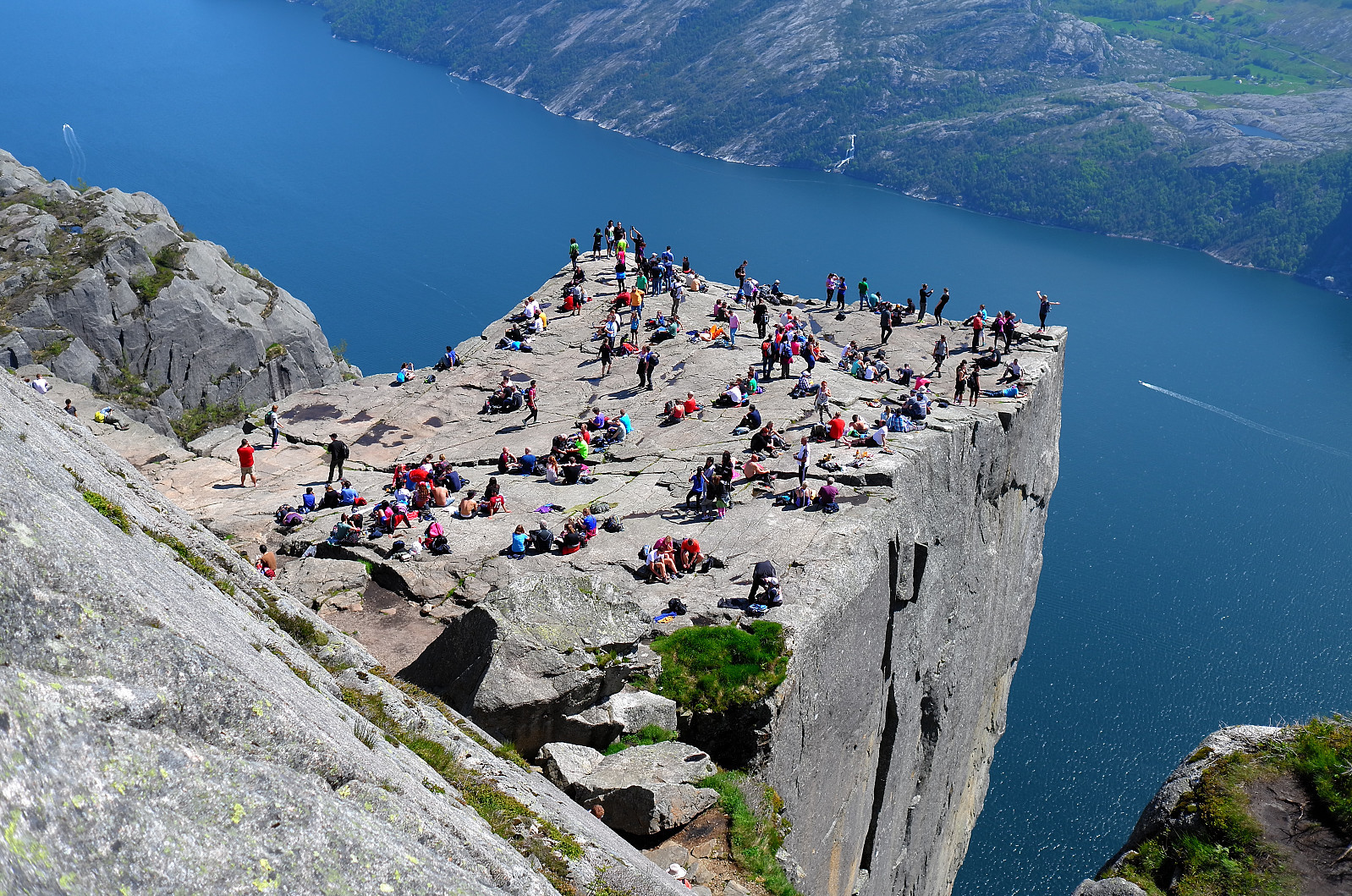
Photo: Otto Lund
Preikestolen is one of Norway's most iconic hikes and offers a spectacular view over Lysefjorden. The hike is moderately challenging and suitable for most people with normal physical fitness. The plateau, which is 604 meters above the fjord, provides an unforgettable nature experience.
The hike starts from Preikestolen Fjellstue, which is about a 40-minute drive from Stavanger. There is parking, a café, and accommodation options available here.
The trail begins with a steady ascent through forest terrain and stone steps, before opening up to a more rugged mountain landscape. Along the way, you pass small lakes and open areas with great views. The last part of the hike goes over a wide mountain ledge before finally reaching Preikestolen itself, a flat mountain plateau that drops straight down into Lysefjorden. Here, you can enjoy the impressive view and take a well-deserved break.
Hiking over the Queen's Path in Hardanger
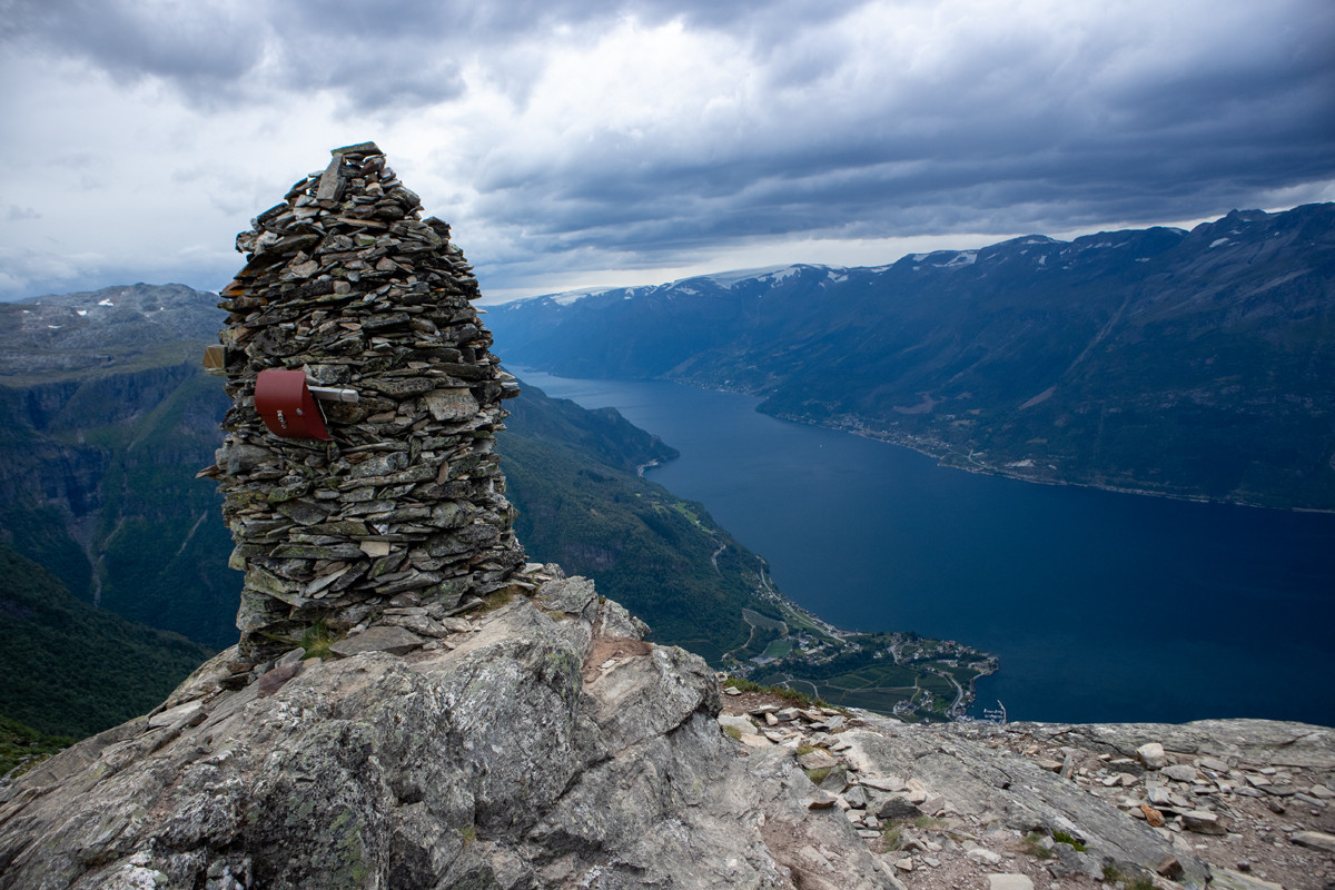
Photo: Jeanette Ekren
The most common is to start the hike at Røte and walk over the mountain down to Lofthus. It is also possible to go the opposite way.
If you have two cars, you park one car in Lofthus and the other at Røte.
You can also take a bus back towards Kinsarvik. Get off at Røte and then walk up to get the car.
An alternative is to park the car in Lofthus and take a shuttle bus in the morning to the hike start at Røte.
We started this hike at the lower parking lot at Røte. From here, you can either walk the road to the upper parking or take a shortcut through the forest. (See the sign at the beginning of the lower parking).
From the upper parking lot, a gravel road follows that winds up the mountainside. At about 750 meters above sea level, the gravel road turns into a path. Follow the Queen's Path that moves south parallel to the Sørfjord. There is a great view all the way and many impressive viewpoints. The cairn at the mountain peak Duk (1105 meters above sea level) and Nosi (905 meters above sea level). The latter is a detour just before the descent to Lofthus. The hike is well marked and the path is good. Right before the descent at Rjukande, the path suddenly turns northwest. Then you will enter the 'Monk Steps' which were made by local monks inthe 1200s.
The last part of the trip down to Lofthus goes on a path and further on a tractor road. To Save time, one can take the trails through the forest.
Poles are recommended for descending to Lofthus.
Mountain hike to Trolltunga (1100 m)

Photo: Chris A.
If you get parking at P3 and start at Mågelitopp, the trip will be easier. You Save 4.3 kilometers and 400 meters of elevation gain plus the return down. You can also take the shuttle bus up here.
We started down (P2) and went up all 17 hairpin turns. Then the trip continued on a beautiful path marked with metal pins. We crossed some bridges before the steep ascent up Gryteskaret. When we reached the top, it was just to follow the markings (bamboo poles in the snow and small stone cairns) all the way through hilly terrain. From here, the trip becomes much easier.
When one passes the slope up past the first rescue cabin, one gets a great view of Ringedalsvatnet and to the west, one can constantly glimpse Folgefonna. Then it's just to follow the marked path all the way to Trolltunga.
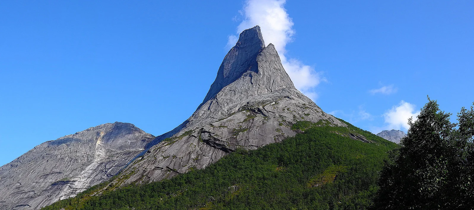
Mountain hike to Stetind (1391 m) - Norway's national mountain
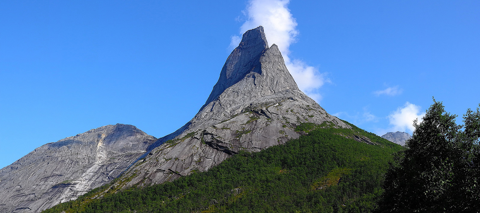
Photo: Otto Lund
Stetind, also known as Norway's national mountain, is a spectacular mountain hike for experienced climbers and mountain enthusiasts.
With its characteristic needle-shaped peak and steep mountain sides, Stetind offers a airy and challenging ascent. The trip requires both good physical condition and climbing experience, especially on the last sections towards the top.
From the parking lot, you follow the path through easy forest terrain before you reach the steeper ascent towards Halls Fortopp (1314 m). From here, the route becomes more demanding with airy climbing and exposed sections. The final stretch to the top requires safety and climbing gear, as you must traverse the famous 'Finger traverse' - a narrow and exposed ridge.
At the top, you are rewarded with one of Norway's most impressive views, where you can gaze over fjords, mountains, and the sea as far as the eye can see.
Galdhøpiggen (2469 m) from Spiterstulen

Photo: Chris A.
Galdhøpiggen is located in Jotunheimen National Park and is Norway's highest mountain with an elevation of 2469 meters above sea level. The mountain is one of Norway's most popular hiking destinations.
From the top of Galdhøpiggen, you have a fantastic panoramic view of Jotunheimen's many 2000-meter peaks. On clear days, you can see all the way to Rondane, Dovrefjell, and Jostedalsbreen. At the top, you will also find a stone hut, which is used as a serving place in the summer season. This route from Spiterstulen (1100 meters above sea level) goes steeply upwards in rocky and snowy terrain with an elevation gain of almost 1400 meters and takes 6-9 hours round trip. If you want a shorter route, you can walk from Juvasshytta, but then you must cross Styggebreen, a glacier that requires glacier hiking withguide.
Hiking to Europe's highest sea cliff Hornelen (860 m)
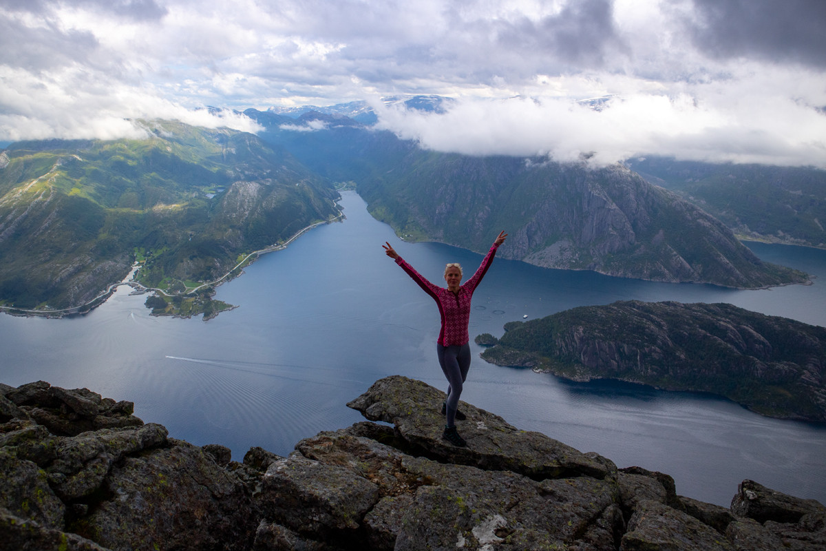
Photo: Chris A.
Go to the end of the parking lot. Here there is a sign marked Hornelen as well as a description of the trip. Walk through the forest and up the stone steps. Just before the steps end, you can follow the path to the left. It goes in an extra curve but is much better than where the stone steps lead you.
If there has been a lot of rain, it may be worth going where the stone steps end as you avoid crossing a river. Both routes will lead you to the same path further up the slope.
Follow the marked path through the forest. It is steep so the vegetation disappears quickly. At about 300 m, the view over the fjord improves. Follow the ridge up to 550 m. Now the path turns south and there is a new steep section. At the top, it flattens out and goes downhill. Now the landscape turns into rocky mountain terrain. Cross between the two small lakes and follow the marked path southeast. Another steep climbing section before you reach a long valley. Now you just have to follow the flat landscape into the valley. The path is marked with red T-posts and is facilitated.
Follow the marked path to the left of Uraheia where it goes steeply down into the last valley. Here it is very rocky so watch where you put your feet. Down in the valley, you will join the path coming from Berleneset. Follow the marked path inwards before the last steep ascent to the top.
Just before the top, there is a deep gorge. Be aware of this. It is not a problem to cross it further up towards the top.
At the summit cairn, there is a nice 360-degree view. You can see Måløy, Bremangerlandet, and wind turbines. There is also a stone cabin where you can seek shelter, Olavsbu. For the alpine view down into the fjord, you must go further towards the edge. There are several tough viewpoints for those without a fear of heights.
Return the same way. Have a good trip!
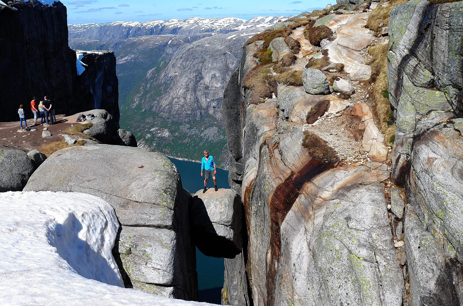
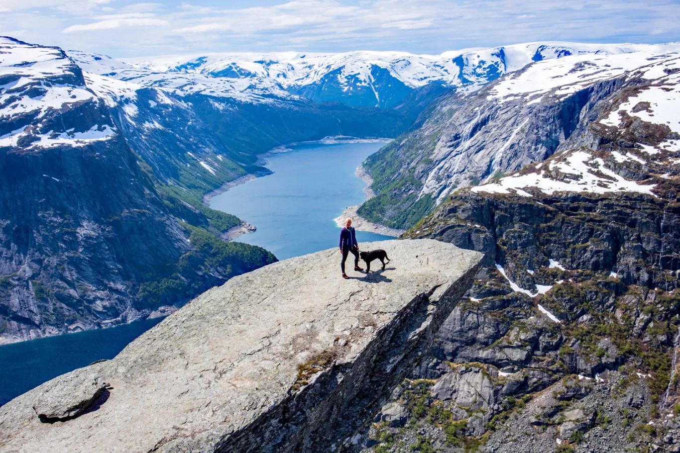
Hiking to Kjeragbolten (990 m) in Lysefjorden

Photo: Otto Lund
This trip takes you to the iconic Kjeragbolten, a boulder wedged between two mountain walls 990 meters above Lysefjorden.
The hike starts from Øygardstøl, which is located by Lyseveien. There is parking, a café, and toilets here, making it easy to prepare for the trip.
The trail starts with a steep ascent, where chains are attached to the mountain for extra support. After the first part, the terrain flattens out before another steep ascent takes you further up. Along the way, the landscape alternates between stones, mountains, and small marshy areas, providing a varied and exciting experience. After the final ascent, you reach the Kjerag plateau, where a short walk over mountain terrain leads to the Kjeragbolten itself.
Remember to be careful if you plan to step out onto the Kjeragbolten. It is an incredible experience, but it also requires respect for the height and surroundings.
The return trip goes the same way.
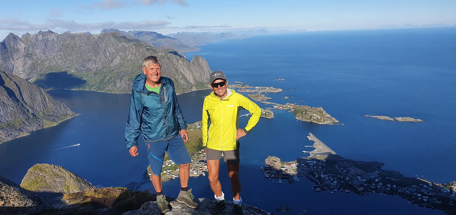
Mountain hike to Reinebringen (484 m) in Lofoten

Photo: Johan Solberg
One of the most popular mountain hikes in Lofoten. At the top, you get spectacular views over the Reinefjord, the mountains, and the islands in the area. Although the hike is relatively short, it is steep and challenging, but the reward at the top is one of the most iconic views in Norway.
The trail up to Reinebringen mainly consists of stone steps built by sherpas to make the hike safer. The trail is steep and rises quickly, but the solid steps provide good footing.
The hike is best from June to September. Outside of the season, there may be ice and snow, making the trail dangerous.
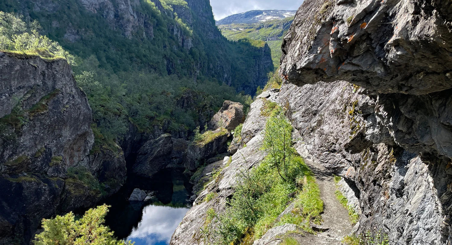
Hiking through Aurlandsdalen
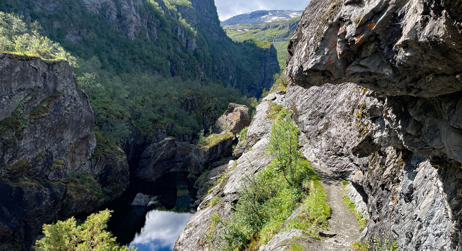
Photo: Jeanette Ekren
Have you not yet hiked Aurlandsdalen? Then it's time!
The stretch from Østerbø to Vassbygdi goes through lush valleys, dramatic mountain formations, and historical pasture areas. The hike is often called 'Norway's Grand Canyon' due to its impressive landscapes and varied nature.
The hike starts at Østerbø Fjellstove, which is located about 820 m above sea level. Here it is possible to stay overnight and buy food before the hike begins.
The trail follows Aurlandsdalen down through a varied landscape with lush meadows, steep mountain sides, and wild waterfalls. Along the way, you pass historical sites such as Nesbøgalden, a narrow path along the mountain wall, and Vetlahelvete, an impressive pot hole. The terrain alternates between easily walkable paths, steep descents, and narrow passages.
The last part of the hike towards Vassbygdi (50 m) goes through forest terrain and opens up for a fantastic view over the valley.
Mountain trip to Gaustatoppen (1883 m above sea level)
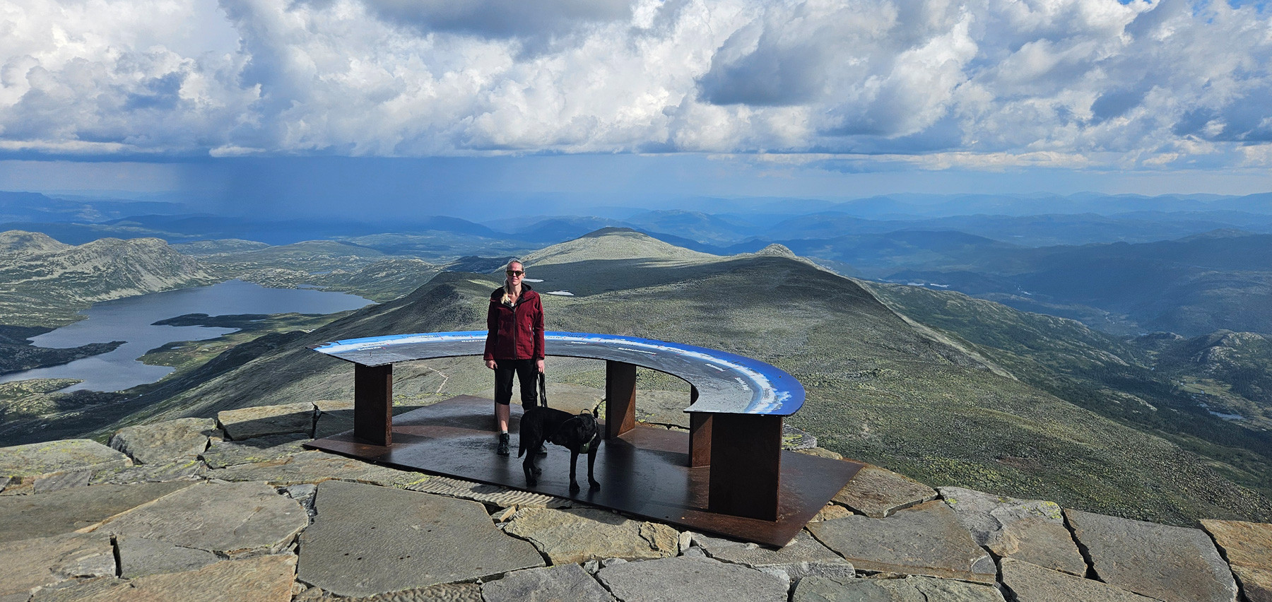
Gaustatoppen is one of Norway's most iconic mountain peaks and offers a spectacular view over large parts of Southern Norway. On clear days, you can see about a sixth of the country from the top.
The trip starts from the Stavsro parking lot (1173 m above sea level), which is located along the road between Rjukan and Tuddal.
The trail starts in an open mountain landscape and steadily rises through rocky terrain. Along the way, there is fantastic views of the mountains around Rjukan. The last kilometers up to the top go through scree, but the trail is well marked. At the top, you will find the Gaustatoppen tourist cabin, where you can buy food and drinks.
For those who want an easier descent, you can take the Gaustabanen, a mountain railway that runs inside the mountain.