5 different routes to Ulriken


The impressive mountain peak that towers over Bergen is not only a scenic landmark but also a popular hiking destination. Here we present five different routes to the top.
Advertisement


Mountain hike to Ulriken (643 m) from Årstad
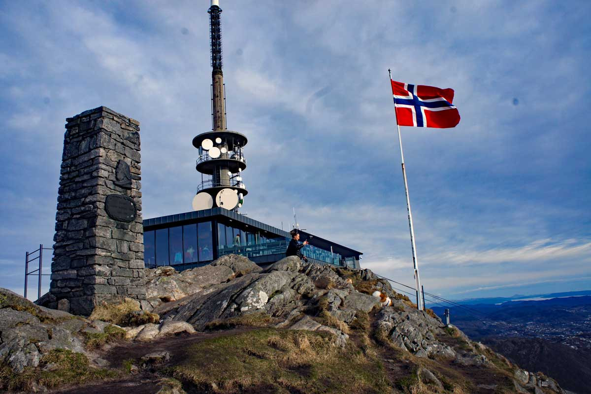
Photo: Admin
Your hike starts at the parking lot located just below the Svartediksdam. You begin by walking down Stemmeveien and take a left over the bridge into Bjørndalesveien. Continue to keep left to reach the end of the road. From the top of Bjørndalen, you see a path that goes up along the waterfall in Støleelven. The path is called Stølekleiven. It starts steeply through the forest and further into open mountain terrain. When you see the Ulriksmast, you enter the staircase path (Oppstemten) that leads you to the top.
Learn more about the trip here
Isdalen up to Ulriken (643 m)
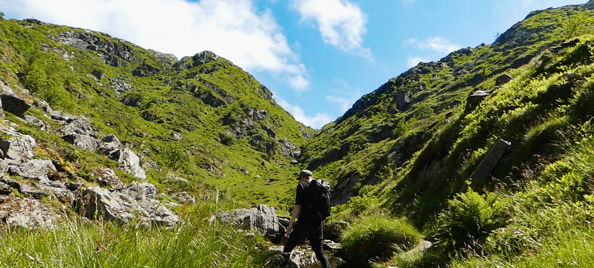
Photo: Stian Berthelsen
Isdalen up to Ulriken is a little-used but very nice hike in varied terrain with beautiful viewpoints.
Start the hike on Tarlebøveien along Svartediket. Turn right at the sign towards Isdalen. Take the next road to the right over a small bridge and follow the gravel road to the end. Here there is a sign for Isdalen, but the start of the path is hard to spot. Look for the sign with an arrow showing where to go. The path is quite overgrown at the beginning but not difficult to follow. Halfway up Isdalen, you are above the tree line, and the rest of the hike goes through lush and idyllic mountain terrain.
Just before the top, there is a steep section, but it is not challenging to overcome. It may be a bit slippery to go down on rainy days. At the top, you meet the path over Vidden and can choose to go right towards Ulriken or left towards Fløyen. From Ulriken, there are many options down, including the sherpa stairs Oppstemten or the new Ulriksbanen.
Learn more about the trip here
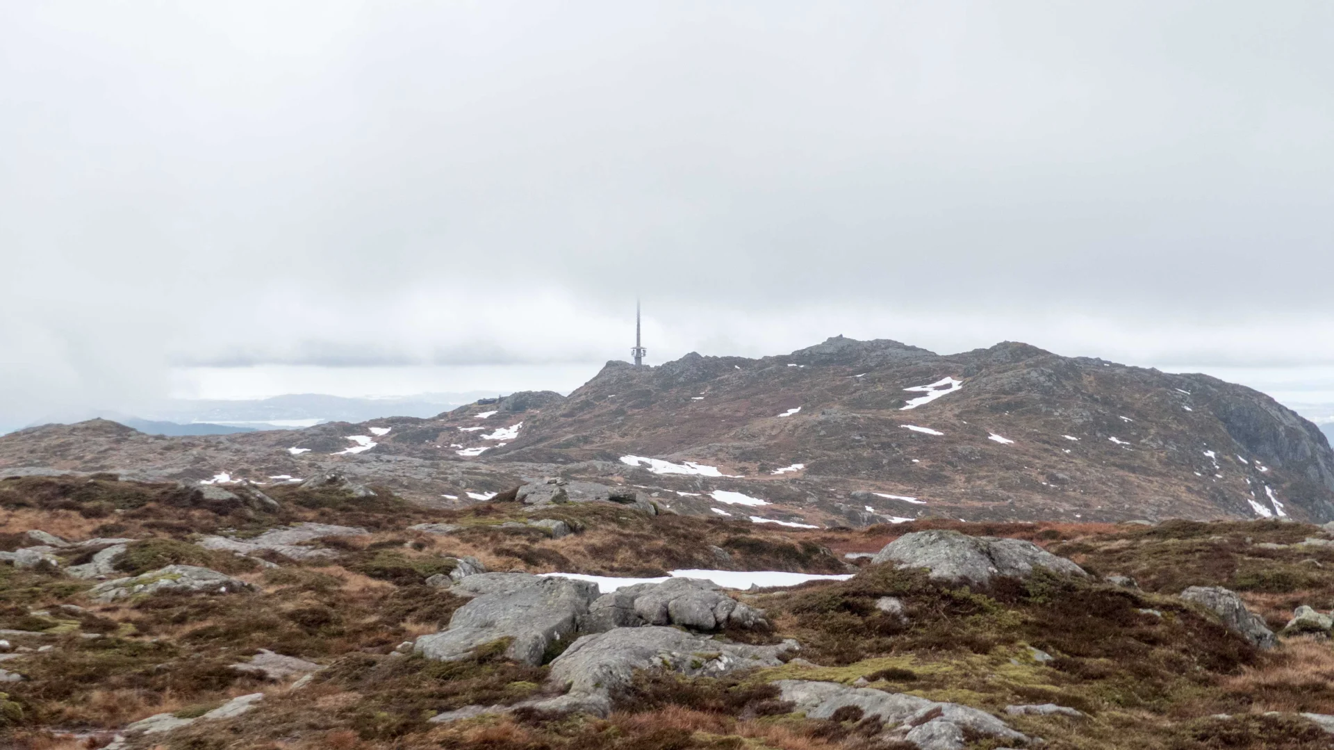
The staircase path Oppstemten to Ulriken (643 m)
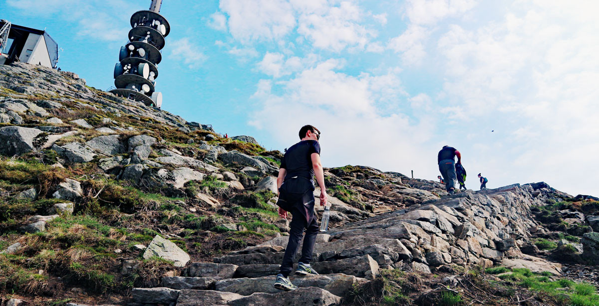
Photo: Chris A.
The staircase path Oppstemten to Ulriken (643 m). This hike starts at Ulriksbanen. Follow the path to the right through stone fields and forest to Montana. Then a gravel road up to Steinen where the stairs begin. The staircase path is made by sherpas and consists of about 1500 steps and is 750 meters long.
Learn more about the trip here
Ulriken (643 m) up Ulrikseggen
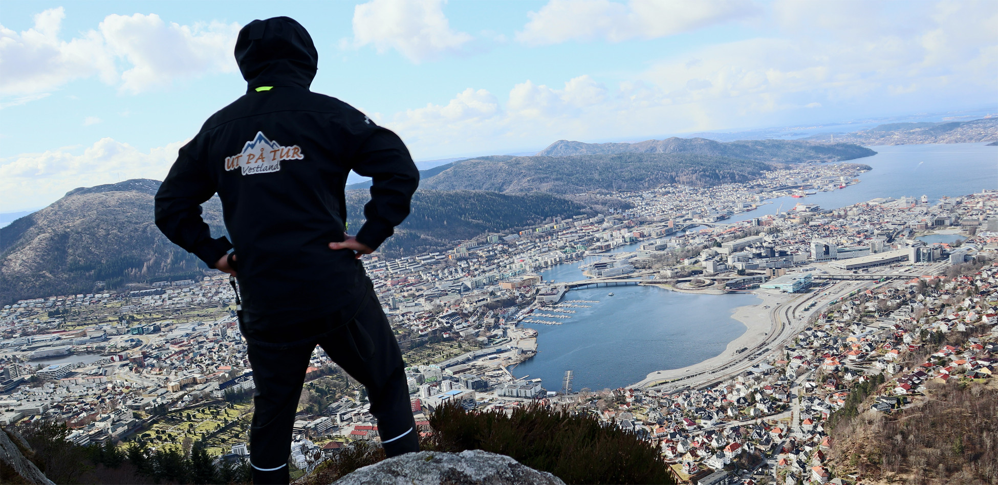
Photo: Chris A.
The Ulrikseggen is the steepest route up to Ulriken. The ridge goes steeply upwards on the northwest side of the mountain. To reach the top, you start by walking around Svartediket. When you reach the intersection at Isdalen, continue straight on the road and choose the road that goes left. After about 300 meters, a path goes up into the forest (left side). Follow this. There is a steady ascent at the beginning, and you have to cross some wet areas / bogs. Then it becomes steeper with some easy climbing sections. There are several viewpoints on the way to the top. The hike up is not exposed,but can feel airy if you have a fear of heights. When you reach the top of the ridge, it flattens out and you follow the path to Ulriksmasten.
Learn more about the trip here
The plateau the opposite way . . .from Fløyen to Ulriken

Photo: Chris A.
The trip starts from the lower station of the Fløibanen. Follow the road up to Skansen fire station and further up to Fjellveien. Over on the gravel road up Tippetue and then continue past Fløyen to Brushytten. Here it is possible to buy waffles, chocolate, chips, coffee, and similar on weekends as well as weekdays during the summer season. Continue on the paved road up towards Rundemannen. Here you get a fantastic panoramic view over all of Bergen and the surrounding area, and you can see how the plateau stretches all the way to the top of Ulriken.
Continue past Rundemannen down along Tarlebøveien until you reach the information board and turn left. Now the actual plateau hike begins. After about 1 km you reach Øvre Jordalsvannet and here begins an ascent of about 100 meters. Further on, there is a gentle ascent over the plateau which makes the trip a bit harder than if you walk from Ulriken to Fløyen.
Upon arrival at Ulriken, there are several options for the descent. Either take the cable car down (closed for renovation while I was there), walk the sherpa steps in Oppstemten, or take the path to the left.